Wylam to Newburn Walk – River Tyne Trail

This Wylam to Newburn Walk is a 2.9 mile (one-way) section of the Daft As A Brush trail.

This is a pleasant, easy walk with various points of historical interest, especially for those interested in railways.

Please note I am not providing detailed maps or instructions of the route. You will find all that in Daft As A Brush’s book. You can buy a copy here with proceeds going to support the charity’s good works.

Start Point

Wylam Car Park

End Point

Tyne Riverside Country Park. There is plenty of free parking here.

Highlights

It is well worth popping into the Wylam Railway Museum. It is small but packed with interesting exhibits relating to the development of railways in the region and in particular the role of famous railway pioneer George Stephenson who was born here in 1781.

The first part of the walk from Wylam follows the route of the old Wylam Waggonway, a horse-drawn method of transport built in 1748 for transporting coal, originally along wooden rails and later on iron rails. The waggonway was replaced by a railway line in 1876 linking Wylam to Newburn and Scotswood. After the railway closed in 1968 the track was removed and the Waggonway became a public bridleway.

This charming whitewashed cottage was George Stephenson’s birthplace, now owned by the National Trust. He and his family lived here until he was eight, sharing with three other families. Seeing the horse-drawn coal wagons passing in front of his window may well have triggered his interest in developing steam powered locomotives.

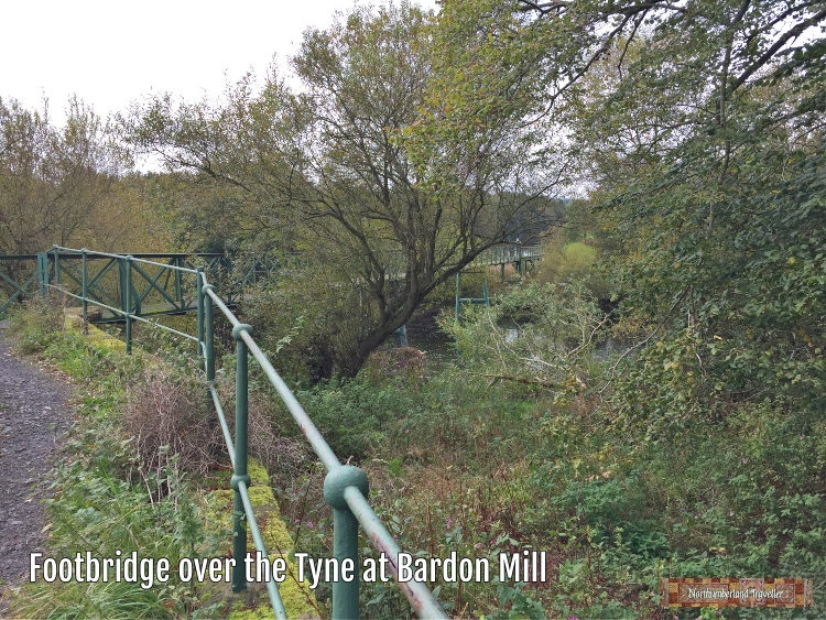
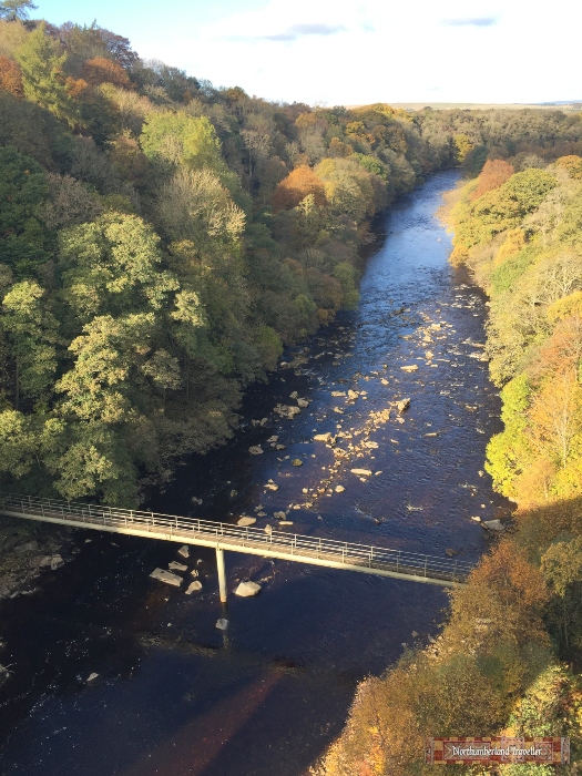
From here the River Tyne Trail runs close to the riverbank passing through Calaminarian grassland, a habitat where rare wild plants have adapted to survive on soils rich in toxic heavy metals left over from mining activities.

There used to be many ferry crossings on the Tyne and this Ferryman’s Cottage on the opposite bank marks the spot of the Ryton Ferry.

A blob of outdoor art on the riverbank at Newburn.

You might want to end your walk with refreshment at the Keelman Pub and Big Lamp Brewery which is housed in the former Newburn Water Pumping Station, built in 1854.

Nearby Attractions

Wylam Railway Museum
Wylam Station

You can read more of my Daft As A Brush Trail walks here.

Newburn to Scotswood Walk – River Tyne Trail

This Newburn to Scotswood Walk is a 2.9 mile (one-way) section of the Daft As A Brush trail.

This may not be the most scenic stretch of the the River Tyne Trail passing as it does though an industrial and business park but nevertheless there are some points of interest. I even saw a seal here!

Please note I am not providing detailed maps or instructions of the route. You will find all that in Daft As A Brush’s book. You can buy a copy here with proceeds going to support the charity’s good works.

Start Point

Tyne Riverside Country Park. There is plenty of free parking here.

End Point

B&Q Newcastle-Scotswood.

Highlights

On the riverbank next to the car park is the site of the Battle of Newburn Ford between the the Scots and English in 1640. Before the Tyne was canalised in the late 19th century it was possible to cross the river here at low tide and if the Scots could break the English defences here they could cross the river and attack Newcastle from the less well-defended south side. They succeeded in doing so and entered Newcastle in triumph on 30th August 1640. King Charles I had to pay a ransom of £200,000 to the Scots to get the city back.

On both sides of the river here are boathouses for various rowing clubs; Tyne Amateur Rowing Club, Tyne United Rowing Club and Newcastle University Boat Club.

The logo for the Tyne Amateur Rowing Club (founded in 1852) features an image of the River God Tyne. The three strands of his beard represent the three sections of the river – River North Tyne, River South Tyne and River Tyne.

The sign of the nearby Boathouse pub (which was closed and boarded up) depicts a coxed four competitive rowing team. The wall of the pub bears inscriptions marking the high water levels reached in historic flooding events including the Great Flood of 1771 when the whole ground floor would have been under water.

A blue plaque on the same building records that from 1798 to 1801 George Stephenson was in charge of Robert Hawthorn’s new pumping engine at Water Row Pit, where George’s father, Robert was fireman. The old cottages at Water Row were demolished in the 1930s as part of slum clearance and only the Boathouse remains.

From here the River Tyne Trail passes through a rather dreary industrial estate, including a Warburtons bread factory before emerging onto a riverfront embankment walkway called Newburn Riverside.

I was surprised to see a seal wallowing in the mud here. I didn’t know they venture this far upriver (maybe 15 miles from the sea).

Nearby Attractions

Lemington Glass Works Cone (now a showroom for Stanegate Stoves)
Newburn Motor Museum

You can read more of my Daft As A Brush Trail walks here.

Bardon Mill to Haydon Bridge Walk – River Tyne Trail

This Bardon Mill to Haydon Bridge Walk is a 7 mile (one-way) section of the Daft As A Brush trail.

This scenic and enjoyable hike ended up being longer than planned because I failed to check Daft As A Brush’s website before starting out for updates on route amendments. Had I done so, I would have found out that the ‘wobbly’ suspension footbridge across the River Allen was washed away some time ago. This would have saved me some shoe-leather but the unintended diversion gave me the chance to see more of the ancient forest at Allen Banks.

Start Point

Bardon Mill railway station.

End Point

Haydon Bridge railway station. I parked my car at Haydon Bridge, caught the train to Bardon Mill and walked back.

Highlights

From Bardon Mill station you take a metal footbridge across the Tyne.

The route passes through the quaint village of Beltingham. A corner of the graveyard at the village church, St. Cuthbert’s, is reserved for members of the distinguished and colourful Bowes-Lyon family including Francis Bowes Lyon, uncle of Queen Elizabeth the Queen Mother.

The Queen Mother planted this tree in the churchyard in 1989.

The trail continues by turning left here at the Victorian letter box.

Looks like somebody took a pot shot at this road sign near Ridley Hall.

The best part of the walk is through the heavily wooded Allen Banks and Staward Gorge valley. The Allen is a tributary of the River South Tyne.

I crossed the River Allen at Plankey Mill where lead smelting mill ruins can be found.

From here a footpath across fields and a quiet country road eventually bring you to a point above Haydon Bridge near Langley Castle.

On the edge of Haydon Bridge you pass East Land Ends farm where local artist John Martin was born in 1789.

Nearby Attractions

Vindolanda
Langley Castle
John Martin Heritage Trail

Chesters to Warden Walk – River Tyne Trail

This Chesters to Warden Walk is a 3 mile (one-way) section of the Daft As A Brush trail.

All of this stretch is along roads, mostly the B6319 which has no pavements but has almost no traffic so is safe enough to walk.

Please note I am not providing detailed maps or instructions of the route. You will find all that in Daft As A Brush’s book. You can buy a copy here with proceeds going to support the charity’s good works.

Start Point

I parked at the Chesters Roman Fort car park (free for English Heritage members). Of course you shouldn’t park in their car park without visiting Chesters. I’ll write about Chesters Roman Fort and Museum in a later post.

End Point

Boatside Inn, Warden (parking for patrons only).

Highlights

Chesters Stables at Walwick Hall. This attractive building was built in 1891 as the stable block for the Chesters Estate. It has recently been converted into luxury self-catering accommodation as part of the Walwick Hall boutique country hotel and spa. For anyone planning to walk Hadrian’s Wall in style, this would be a smart place to break the journey.

Remains of an ancient monument (cross?).

Some of the route was partially flooded (this walk was in October 2019) but when the sun came out it was pleasant enough.

Church of St.Michael & All Angels, Warden. The church describes itself as ‘one of the cradles of Christianity, not only in the north of England, but in Britain.’ St John of Beverley, Bishop of Hexham was thought to have founded an oratory at Warden in 704AD, as a private prayer retreat. The early foundations of the church used Roman-era masonry.

The name ‘Waredun’ meant a look-out hill and referred to the hill overlooking the village.

The lower portion of the church tower is one of the oldest Saxon towers in Northumberland and survived the Danish invasions which destroyed so many churches. Most of the church that we see today dates from 1764.

An ancient stone cross was moved to the churchyard in 1957 from an unknown location. Perhaps it was the top part of the ancient monument mentioned earlier. A plaque reads ‘Warden Village Cross. Early 7th Century.’ Looks more like a sword to me.

A few graves are enclosed by iron hoops which were added to prevent grave robbers from stealing bodies for sale to medical schools. This ghoulish practice was seemingly widespread in the 19th century.

This ornate lych gate was erected in 1903. Coffins were sheltered under the gate while waiting for the clergyman to perform the burial ceremony.

Nearby Attractions

Chesters Roman Fort and Clayton Museum
Brunton Turret – Hadrian’s Wall

Walk from Lambley Viaduct to Featherstone Castle – River Tyne Trail

This walk from Lambley Viaduct to Featherstone Castle is one of the most scenic and interesting sections of the Daft As A Brush trail.lambley-viaduct-to-featherstone-castle-walk

You can do it either as a one-way trip along the east bank of the River South Tyne or, as I did, as a circular 4.5 mile route by coming back to the start point via the trackbed of the former Haltwhistle to Alston Branch Railway.


Start Point

I parked at the small Coanwood Car Park.

End Point

Featherstone Castle (unless you walk back to Coanwood Car Park).

Highlights

lambley-viaduct-to-featherstone-castle-coanwood

The trackbed of the Haltwhistle to Alston Branch Railway from Coanwood Car Park towards Lambley Viaduct now forms part of the South Tyne Trail.

lambley-viaduct-to-featherstone-castle-viaduct

Lambley Viaduct is a massive and spectacular piece of engineering for a relatively minor railway. It was built by the Newcastle and Carlisle Railway Company and opened in 1852 to complete the Haltwhistle to Alston branch line. Its main purpose was to transport lead, coal and limestone which were mined in the area but it also provided a passenger service until it closed down in 1976.

lambley-viaduct-to-featherstone-castle

The viaduct’s architect was railway engineer Sir George Barclay-Bruce. It was built of sandstone and its 9 main arches and 7 smaller spans supported trains 105 feet above the River South Tyne. After some years of neglect, the viaduct was restored during 1995 and 1996.

lambley-viaduct-to-featherstone-castle-pedestrian-bridge

You can walk across the viaduct and admire the far reaching views before descending a steep slope to cross back over the Tyne using this pedestrian bridge pictured here from the top of the viaduct looking down.

lambley-viaduct-to-featherstone-castle-river-tyne

If you are lucky with the weather you can enjoy a lovely walk close to the river bank.

lambley-viaduct-to-featherstone-castle-POW-camp

You will pass the site of Camp 18 where thousands of German Officer Prisoners of War were held from 1945-1948. The foundations of nissen hut blocks and a few brick buildings are all that remain. The POWs underwent a programme of denazification before being released and returned to Germany. The POWs produced their own newspaper, Die Zeit am Tyne.

lambley-viaduct-to-featherstone-castle-ghost

The origins of Featherstone Castle go back a thousand years with many extensions and alterations over the centuries. It is not open to the public but parts of the property can apparently be rented out for weddings and functions. Given the castle’s great age it is not surprising to hear stories of it being haunted, especially on 17th January each year when a ghostly wedding party is said to make an appearance.

Please note I am not providing detailed maps or instructions of the route. You will find all that in Daft As A Brush’s book. You can buy a copy here with proceeds going to support the charity’s good works.

lindisfarne-gospels8-2

Walk the River Tyne Trail, Sources to Sea and Support the Daft as a Brush Cancer Charity

The River Tyne Trail is a wonderful 135 mile hike tracing the River Tyne from its two sources, north and south, to Tynemouth and South Shields where it flows into the North Sea.

The Trail is the brainchild of Brian Burnie, founder of a cancer charity called Daft as a Brush Cancer Patient Care. Together with his mates, Peter Donaghy and John Laidler, he conceived the trail as a way of raising awareness and funds for his charity which provides transportation for cancer patients to get to and from hospital.

“It’s a long walk for my little legs!”

I first became aware of the trail when I saw a stone monument marking the end of the walk near the north pier at Tynemouth. I had earlier wondered whether it would be possible to walk along the banks of the River Tyne all the way from Tynemouth to its source so when I found out that it had already been done I straight away sent away for the Daft as A Brush guide book to learn more.

Being a bit daft as a brush myself I decided I would have a go at walking the trail, or the majority of it at least. The scenery is great and varied and there is a lot to see along the way. I would urge you to give it a go.

The authors of the guide book (Donaghy and Laidler) divided the 135 mile trail into 12 stages, averaging about 11 miles per stage. I have divided it into shorter stages, partly because I find 11 miles a bit long but mainly because my practice is to park at one end, walk for a few miles, and then walk back again to my car. This means I will have to walk twice as far – 270 miles – to complete the whole trail. Now that really is Daft!

Listed below are the stages I have completed so far which have been spread over several months in all kinds of weather. I’ll write about some of the highlights in future blog posts.

Please note I am not providing detailed maps or instructions of the route. You will find all that in Daft As A Brush’s book. You can buy a copy here with proceeds going to support the charity’s good works.

Stages of the Trail completed so far:

River South Tyne

Source of South Tyne to Hole House
Garigill to Alston
Lambley Viaduct to Featherstone
Bardon Mill to Haydon Bridge
Haydon Bridge to Allerwash Mill
Allerwash Mill to Warden

River North Tyne

Chesters to Warden
Chollerton to Chollerford

River Tyne

Warden to Hexham
Hexham to Dilston
Dilston to Corbridge
Corbridge to Riding Mill
Broomley to Stocksfield
Stocksfield to Cherryburn
Cherryburn to Ovingham
Ovingham to Wylam
Wylam to Newburn
Newburn to Scotswood

I’ll add new sections as I complete the remaining stages. I can’t promise I’ll cover every single inch of the trail but I’ll try to include the most scenic parts.

Hope this inspires you to do the walk and maybe raise funds for Daft As A Brush at the same time.