High Road Across Malaysia – Coast to Coast via Cameron Highlands, Gua Musang & Lake Kenyir

IMG_6007b

The usual way of crossing from the West Coast of Peninsular Malaysia to the East Coast, at least for people in the Klang Valley area, is via the East Coast Expressway from KL to Kuantan. It’s an excellent road with some nice scenery and the 250 km journey can be completed in about 3.5 hours.

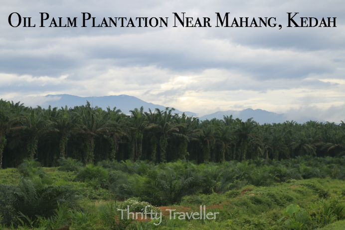
I wanted to try an alternative route, much longer and slower and hopefully even more scenic via the Cameron Highlands and Gua Musang and from there on minor roads though palm oil plantations as far as Lake Kenyir in Terengganu. Here is a map:

Google Maps calculates the distance as 502km and the travelling time as 8.5 hours though I would not recommend attempting it all in one day. I lingered 3 days on the trip.

I started my trans-Malaysia crossing at Kampung Pasir Panjang Laut, a small village near Sitiawan, Perak on the shores of the Straits of Malacca.

This was the western-most point of the route, a small patch of unhealthy mangrove forest in front of an interesting Chinese temple called Tua Pek Gong.

One of its main attractions of Tua Pek Gong temple was a bendy tunnel in the shape of a dragon which I entered through its mouth and emerged from its tail. The interior walls of dragon were lined with murals depicting the Ten Chambers of Hell and illustrated in gory detail the gruesome tortures which await those who do not live a moral and respectable life in this world. Enlarge the bottom right photo above for an example.

Having seen enough, I drove inland on Highway 5 through Sitiawan and Ayer Tawar.  My route road crossed the Perak River near Bota Kanan where I visited the Conservation Centre for River Terrapins.

There were some sizeable mature terrapins in a couple of the holding ponds but they were fairly shy and only popped their heads above water to take bites from floating cabbage leaves.

Continuing on Route A15, I passed a sign for Tanjung Tualang Tin Dredge. I visited this place five years ago (and blogged about it) but decided to drop in again because I had read somewhere that it is now possible to go inside this giant relic from Malaysia’s tin-mining era. Sadly that was not the case. Renovation work was still ongoing and visitors were only allowed to view the exterior for the time being.

IMG_5865
Weaver birds’ nests at Tanjung Tualang.

Next stop was the small town of Malim Nawar. A quirky tourist attraction here was a brick chimney built by the Japanese during WWII for the manufacture of carbide, which is presumably the black charcoal like stuff shown below.

Next stop, still in Perak, was the town of Kampar, once a centre of tin-mining as evidenced by the large number of lakes left over from mining activity which can be seen in this Google Maps image.

Screen Shot 2016-08-22 at 7.21.35 PM
Google Map showing the lakes and ponds near the town of Kampar which were the result of tin mining.

Nowadays Kampar is thriving as a university town with the campus of University Tunku Abdul Rahman located here with other universities nearby. Here are some photos of the Kampar, mostly the old part of town.

Military historians will know that Kampar was the site of a significant battle during WWII and one of the few Allied successes in the whole Malayan Campaign. Most of the fighting took place on a series of ridges on the edge of town near the Chinese Cemetery. I tried finding the Green Ridge where some shallow trenches are supposed to remain. I know I was in the right general vicinity but failed to find any battlefield remains. I should have tried to contact a knowledgeable local guide to show me around this area.

IMG_5898
The Battle of Kampar was fought around here.

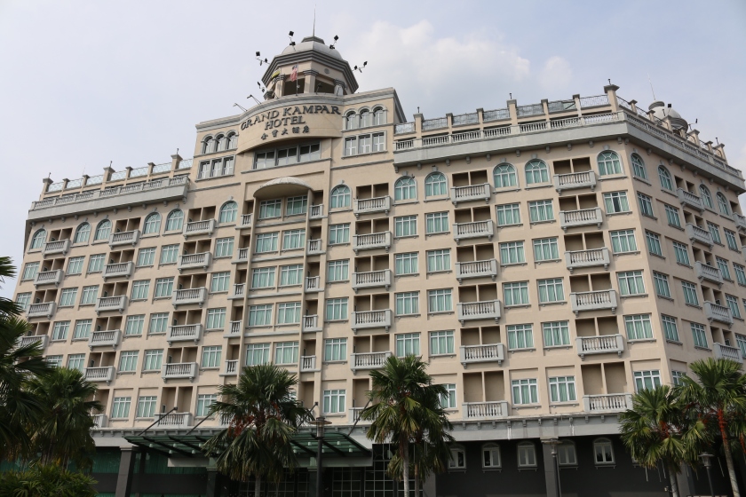
Considering the modest size of Kampar town, it has an enormous hotel, the Grand Kampar Hotel, with 155 rooms. Since they were offering the cheapest rates in town I opted to stay overnight. I asked the front desk manager if they ever managed to fill the hotel. Seldom it seems.

IMG_5938

I’ll continue Part 2 of my High Road Across Malaysia trip in the next blog.

Ubudiah Mosque, Kuala Kangsar

Ubudiah Mosque, Kuala Kangsar
Ubudiah Mosque in Kuala Kangsar is widely recognised as one of the most beautiful mosques in Malaysia.

While in Kuala Kangsar recently I took the opportunity to peek inside Ubudiah Mosque since it was early in the morning and no prayers were going on.

This mosque is thought by many to be the most beautiful in Malaysia, even though it was designed by a British non-Muslim. The government architect was Arthur Benison Hubback who was also responsible for KL railway station,  Ipoh railway station and many other famous Malaysian landmarks. The architectural style is said to be Mogul-Gothic, drawing on elements found in Mogul mosques around India. It was built during 1913-1917.

Bulbous onion dome of Ubudiah Mosque.
The mosque features a bulbous onion dome and four main 126 feet high minarets each topped by an Indian style ‘chatri’.

The main prayer hall is octagonal and surprisingly small, about 20 yards across. In common with all mosques, there is no furniture inside other than a carved wooden screen, segregating the women’s section, and the minbar (pulpit). The space is air-conditioned.

Interior of Ubudiah Mosque
Interior of Ubudiah Mosque.

The recessed mihrab (the niche designating kiblah, or direction of prayer) is lined with naturally patterned Italian red marble.

Woollen Persian carpet at Ubudiah Mosque
This Persian carpet covering the interior is probably not the original from Hubback’s time.

There is a fine wall-to-wall Persian carpet and a chandelier hanging from the intricately decorated ceiling.

Intricately decorated ceiling of Ubudiah Mosque
Intricately decorated ceiling of Ubudiah Mosque.

The mosque’s guardians found that it was too small for modern day purposes so new verandahs were added in 1993 to accommodate additional worshippers.

Spacious verandahs were added to Ubudiah Mosque in 1993 to accommodate additional worshippers.
Ubudiah Mosque was extended in 1993 by adding verandahs. These have matching red, black and white marble floors to complement the original design.

Next door to Ubudiah Mosque is the Royal Mausoleum where Perak’s Sultans and family members going back to the 1800’s are buried. It is built in similar style to the mosque.

Non-Muslims are welcome to visit the mosque provided they are appropriately attired and visit outside of prayer times.

Victoria Bridge, Karai, Perak

At the small village of Karai, about ten kilometres from Kuala Kangsar, is an old railway bridge called Victoria Bridge (also known as Enggor Bridge). It is the oldest railway bridge in Malaysia and one of the most impressive.

Victoria Bridge, Karai, Perak
Those Victorians knew how to build bridges!

Construction started in 1897 and, after some delays caused by flooding, it was officially opened in 1900 in a ceremony attended by the Sultan Idris Shah of Perak and the British Resident General, Sir Frank Swettenham. In his speech, Sir Frank said that this was the largest bridge in Asia, outside of India.

The single track railway truss bridge is over 1000 feet long and rests on six brick piers which still look in excellent condition despite the frequent severe flooding in this area.

Victoria Bridge, Karai, Perak
Colourfully dressed Malaysians participating in the bridge’s 115 year anniversary celebrations.

On the day I visited there was, by pure coincidence, a celebration going on to commemorate the bridge’s 115 year anniversary. It was hosted by the Minister of Tourism and Culture whose department has made efforts to promote the bridge as a tourist attraction.

115 Year Anniversary Celebrations for Victoria Bridge
Provide free food and Malaysians will come.

There was an army bagpipe band and various stalls and attractions.

Bagpipe band equipment at Victoria Bridge

Army bandsmen

The Ipoh Climbers Community was providing the opportunity to abseil from the bridge for those who were brave enough.

Abseiling from Victoria Bridge

Just walking across the bridge was brave enough for me given the gaping holes with drops down to the Perak River forty feet below.

Victoria Bridge is 40 feet above the normal river level
Mind the gap!

The bridge is no longer used by trains since it has been replaced by a new concrete bridge wide enough to handle double tracking for the electric train service which is expected to be extended up as far as the Thai border some time later this year.

Footpath on Victoria Bridge
Pedestrians and motor cyclists can still use the footpath running alongside the rail track.

At each end of the bridge is a stone sentry post, a hangover from the days of the Emergency when strategic communications links such as this bridge would have been prize targets for the Communist Terrorists.

Pillbox at Victoria Bridge
Pillboxes guard both ends of the bridge.

Now in more peaceful times, the bridge has become a venue for pre-wedding photo shoots.

Wedding photos at Victoria Bridge
This intrepid bride-to-be poses for wedding snaps while taking care not to plummet into the river below.

It is good that this relic of a bygone age is being valued by the Malaysian Government but some maintenance work will be required if it is to survive another 115 years.

Celebrants taking part in the 115 year anniversary for Victoria Bridge on 31 May 2015
Friendly girls welcoming guests (me) to Victoria Bridge’s 115 year anniversary celebrations on 31 May 2015.

Back Roads of Kedah & Perak

I have been exploring some of the more unspoilt corners of Kedah and Perak this week.

St.PatricksHighSchoolKulim
‘Jamaican Sunset’ (allamanda cathartica) blooming nicely outside St. Patrick’s High School.

I started out in Kulim, which was a small Kedah town until the 1950’s but has since mushroomed into a city of a quarter of a million people, thanks partly to the establishment of an industrial estate called Kulim Hi-Tech Park.

Low lying clouds lingering in this sleepy kampung.

Heading east towards the Gunung Inas Forest Reserve, the road passed rural scenery and sleepy villages.

Raging cascade at Sungai Sedim.

It had been raining heavily overnight and the rivers were in full flow.

Tree Top Walk Sungai Sedim
The 950m long Tree Top Walk is said to be the longest canopy walk in the world.

The Tree Top Walk at the Sedim River Recreational Park is one of Kedah’s top attractions.  Although it is of robust construction the elevated walkway has a disconcerting wobble as you walk on it 25 metres above the forest floor.

Pristine Rainforest At Sungai Sedim
The Tree Top Walk provides a great view of life in the rainforest canopy.

There are some challenging hiking trails that begin here. I’ll leave those for another time perhaps.

View From Tree Top Walk
White Water Rafting is another activity available at Sungai Sedim.

Leaving Sungai Sedim I headed south towards Mahang.

OilPalmPlantation Near Mahang Kedah
The sun trying to break through the clouds near Mahang.

The oil palm industry comes in for a lot of criticism from environmentalist types (due to destruction of rainforest wildlife habitat and so on) but these palm plantations can look quite attractive.

Tebing Tinggi Falls Perak
Waterfall in spate after heavy rain.

Near Selama, the highway passes the impressive Tebing Tinggi Falls.

Unspoilt Selama District Perak
Illegal logging is a problem in parts of Malaysia but thankfully not here.

The view from here is a reminder that Malaysia is a big country with still plenty of lush forest areas. Let’s hope they stay that way.

Gua Gunung Runtuh
Near Lenggong in Perak are a number of caves under the control of the Department of National Heritage.

This hill contains a cave in which a 10,000 year old skeleton was discovered which has been dubbed ‘Perak Man’. I struggled to find the cave due to lack of signage but somehow managed to locate it after a half hour hike and much scrambling over wet rocks.

Cave Entrance Gua Gunung Runtuh
The entrance to Gua Gunung Runtuh was hard to find and locked.

It is not surprising that the skeleton was not discovered until 1991. Since the cave was locked I had to content myself with peering through the railings.

A short drive away are a number of other archaeologically significant caves but they too were padlocked which is a bit disappointing for an area which touts itself as a UNESCO World Heritage site.

Skeleton Of Perak Man
The original skeleton of the Perak Man can be viewed at the Lenggong Archaeological Museum, Kota Tampan.

The Lenggong Archaeological Museum displays the original skeleton of the Perak Man when it is not being loaned out to other museums.

Perak Cave Men
Artist’s impression of life 10,000 years ago in a cave in Perak.

As for Lenggong town itself, it seems a quaint place with some old wooden shophouses and a colonial era post office.

Lenggong Main Street Perak
Lenggong Post Office

Last stop on my tour of the back roads of Kedah and Perak was at the tranquil Chenderoh Lake, popular with anglers seeking catches such as Peacock Bass and Toman (giant snakehead).

Chenderoh Lake Perak
This lake was created in the 1920s by building a dam across the mighty Perak River, Malaysia’s first hydro-electric dam and power station.

Kampung Koh, Sitiawan, Perak

Kampung Koh is one of the original villages making up the sprawling settlement of Sitiawan, close to the town of Lumut and nearby to Pangkor Island.

Kg. Koh was founded in 1903 by a group of 360 Methodist Christian settlers from the Chinese province of Fujian who came to Malaya in search of better lives. They were led by two Chinese pastors – Rev. Lin Chen Mei and Rev. Dr. Huang Pau Seng – together with a German missionary called Rev. Dr. H.L. Luering.

Pioneer Methodist Church, Kampung Koh, Sitiawan

They built a church in 1905 at a cost of $900 which burnt down the following year. The current building (above) dates from 1927 and is known as the Pioneer Methodist Church.

Sitiawan Settlement Museum, Kampung Koh, Sitiawan

The church shares a compound with this 80 year old former parsonage which has been converted into the Sitiawan Settlement Museum, showcasing the heritage of the local Foochow community with photos and artefacts from those early pioneering days.

Old wells at Sitiawan Settlement Museum. 

There are some old wells in front of the museum and a plaque explains that the first well was dug by Dr. Shellabear who assisted Dr. Luering in setting up the settlement. These wells provided a continuous source of clean drinking water for the village up until the 1970’s when a piped water supply became available.

Methodist ACS at Kampung Koh, Sitiawan

Across the street is the Methodist Anglo Chinese School.

Wat Sitawanaram at Kampung Koh, Sitiawan

Next door to the church compound is Wat Sitawanaram, a Buddhist temple established by Thai Buddhist monks around 100 years ago. Since it was Wesak Day on the day of my visit the place was heaving with visitors.

Wat Sitawanaram at Kampung Koh, Sitiawan

The main hall contains a large sitting Buddha statue with a smaller reclining Buddha below.

Donating Blood at Wat Sitawanaram at Kampung Koh, Sitiawan

Many devotees were doing their good deed for the day by donating blood.

Wat Sitawanaram at Kampung Koh, SitiawanWat Sitawanaram at Kampung Koh, Sitiawan

Giant Incense Sticks at Wat Sitawanaram at Kampung Koh, Sitiawan

What else is Kampung Koh/Sitiawan famous for?

Chin PengChin Peng, leader of the Malayan Communist Party, was born here in 1924. Throughout the Emergency period he was a thorn in the side of the British and Malaysian authorities and his terrorist tactics were responsible for the deaths of thousands of civilians, police and military personnel.

Shophouses at Kampung Koh, SitiawanPerhaps the dreary wooden shophouses in the centre of town drove him to revolution.

Chin Peng died in exile in Thailand last year. There are no plans to bring his remains back to Sitiawan as far as we know.

Kampung Koh Chili Sauce


Of much more interest to most Malaysians, Kampung Koh is also famous for its delicious chili sauce, a staple ingredient in all local kitchens.


The town is also renowned for its seafood restaurants meaning that the area has considerable potential for gourmet tourists who want to refuel on the way to Pangkor Island.


Last but not least, Sitiawan has a very fine beach of its own, Teluk Batik, which you can read about on my Malaysia Traveller website.

Teluk Batik Beach

Kampung Baru Coldstream

Road sign for Kampung Baru Coldstream

There is a place near Bidor in Perak state with an unusual name, Kampung Baru Coldstream (meaning Coldstream New Village).

I drove there the other day to take a look.


Gateway to Kampong Baru Coldstream

Passing under this Chinese gateway the road passes vegetable fields before arriving at the village.

Kg. Coldstream New Village Community Hall

Kg. Coldstream is one of those ‘new villages’ built during the Malayan Emergency. Scattered communities were forcibly relocated to guarded and fenced villages to protect them from the Communist Terrorists and to prevent the villagers from supplying food, medicines and information to the bandits. I understand the 2nd Battalion of the Coldstream Guards were stationed in Perak during the Emergency and may have assisted with the village’s construction.

Main street in Kampung Baru Coldstream

The Coldstream Guards are one of the oldest and most distinguished regiments in the British Army with roots in the Scottish Borders town of Coldstream, a place which, I imagine, bears little resemblance to its Malaysian namesake.

Chinese Temple, Kg. Coldstream

Today Kg. Coldstream looks a fairly typical Malaysian village with a few shops and food stalls, a school and temple. The inhabitants are mostly Chinese of Hokkien origin. The place looks happy and prosperous. Of course there are no fences or guards anymore.

Bedford RL lorries at Kampung Baru Coldstream

I noticed a transport yard with a couple of ancient 1950’s vintage vehicles in fine working condition. They look like Bedford RL lorries, once the workhorse of the British Army. Could they have been sold off as Army Surplus? Did they fall off the back of a lorry? Or were they just left behind by the Coldstream Guards? It’s the least they could have done in exchange for having the village named in their honour.

Pusing, Perak

Taxi rank at Pusing, Perak

Recently I have blogged about my visits to the old tin mining towns of Gopeng and Tronoh. Next stop on my tour around the Kinta Valley was Pusing, another former tin mining settlement around 14km from Ipoh.

Ninety percent of the population of Pusing are said to be Chinese Hakka, descendants from immigrants from Dongguan County in China. They settled here to work the tin mines in the first few decades of the twentieth century.

Sikh Temple at Pusing

There is also a Sikh community here. Sikhs worked as tin mine security guards, general labourers and bullock cart drivers but, judging by the prosperous appearance of their temple, the younger generations must have moved on to better paying occupations.

P4200080

In the 1930’s there was a row of Japanese owned shophouses opposite the Pusing Malay School. One of these shops was the studio of a Japanese photographer who was probably doing a bit of spying in preparation for the coming Japanese occupation during WWII.

A railway line ran through Pusing before the War. The Japanese ripped up the rails and shipped them off to Thailand/Burma for use on the Death Railway.

During the Malayan Emergency this area was a hotbed of Communist Terrorist activity. Following a series of attacks on the Pusing police station and 12 murders, the High Commissioner Gerald Templer imposed a collective fine of $40,000 on the town, enforced a curfew and closed all shops for a period of 44 days (an unlucky number for the Chinese) as punishment for supporting the communists.

PSM election flag

Perhaps the town still has left-wing sympathies. Pusing and the surrounding towns were the only places in Malaysia where I saw flags for the Socialist Party of Malaysia in the run-up to the recent general election (I don’t think they won any seats).

Malaysia Smelting now Restaurant 333

Pusing does not get much attention in the news these days. Most mentions on the internet relate to food and the Ming Feong restaurant seems to be a favourite place for passing motorists.

Ming Feong restaurant is second from the right

Tronoh, Perak

Tronoh, Perak

The tiny town of Tronoh (sometimes spelt Teronoh) is about 30km south of Ipoh, Perak.

Like the rest of the Kinta Valley, Tronoh is a former tin mining settlement and 100 years ago it was the site of the largest open cast tin mine in the world.

In those days a railway line linked Tronoh to Ipoh but it was dismantled by the Japanese during the war for scrap and never rebuilt.

Old shophouses in Tronoh

Today it is a very sleepy town comprising two or three streets of decaying old Chinese shophouses and some newer suburbs.  There are a couple of restaurants but no hotels. Even the main Ipoh to Lumut highway now bypasses the town, leaving its quiet streets to slumber in peace. A university campus has been opened nearby but its impact on the old town centre appears negligible.

Main Street, Tronoh

The town has had a few moments of fame. Tronoh starred in a couple of films – it was used in the 1981 Hong Kong movie called Father & Son and more recently was the setting for a Malaysian romantic comedy called Ice Kacang Puppy Love (2010). You can see the latter’s movie trailer (in Chinese) if you are interested:

Ice Kacang Puppy Love movie set in 1980’s Tronoh.


There’s not a lot more I can say about Tronoh. Here are a few more photos from my visit in April 2013.

Singer Shop, Tronoh

Singer advertising boards can be found in nearly every Malaysian town but how many people buy their sewing machines these days?

Bicycle repair shop, Tronoh

Some well maintained shophouses

Most of the shops were shuttered up.

Tronoh's kaki lima

Incense coils in Tronoh

Classic shophouse, Tronoh

Gopeng, Perak

It is difficult to imagine now but the small Perak town of Gopeng was once Malaya’s most important mining centre.

Tin mining began here around the 1870s. The first miners were the Mandailing people from Sumatra but they were soon displaced by an influx of Chinese miners. By 1888 the town had a population of 5,000, mostly rough and tough Cantonese and Hakkas not long off the boat from China. They were controlled by secret societies and led by Eu Kong, a successful businessman whose son, Eu Tong Sen, went on to found the famous chain of Chinese medicine shops of the same name and numerous other enterprises.

The tin industry was given a boost by the arrival of British and French mining companies and the opening of a branch of Straits Trading Company which provided finance to Chinese miners and purchased their tin ore.

Gopeng prospered and by the early 20th century the town had a gymkhana club, a courthouse, government quarters, a resthouse and all the other trappings of a typical colonial town. Most of those original buildings were demolished in the 1930s as they were found to be sitting on tin deposits which were subsequently mined.

Gopeng shophouses

Some of the old shophouses in Gopeng have elaborate decorative friezes above the ground floor level.

By 1892 the town had been surpassed by Ipoh in size, wealth and importance but mining activity continued in the area until the tin industry collapsed in the 1980s. Having lost its reason for being, the town fell into decay and young people drifted away to look for work but in recent years Gopeng has tried to reinvent itself as an eco-tourism hub, with white water rafting, tubing, caving, jungle trekking and other activities all taking place nearby.

Sales office for My Gopeng Resort

Gopeng Heritage House captures some of the atmosphere of the town’s glory days with a quirky collection of relics and curios.

Gopeng Heritage HouseFur Coat at Gopeng Museum

The museum has an interesting range of exhibits such as this fur coat and hat, always useful for those chilly Malaysian evenings when the temperature drops below 30˚C!

National Panasonic radio

This radio is an antique of the future perhaps.

Elsewhere in town, a small section of the 105 year old Kampar Water Supply Pipeline has been preserved, the rest of it having been dismantled and sold for scrap in 2008.

Water Pipeline used in mining operations

Just outside the town is one of Gopeng’s newer attractions, the Gaharu Tea Valley. This place is a plantation growing agarwood. Agarwood (also known as gaharu in Malay or oud in Arabic) is an aromatic resinous wood which forms inside aquilaria trees when they become infected with a certain type of mould.  Agarwood is highly prized for its powerful, exotic fragrance as well as its medicinal and health-giving properties.

Gaharu Tea Valley

The Great Wall of Gopeng.

Visitors to Gaharu Tea Valley can sample and purchase the various gaharu products and take a tour round the estate which is surrounded by a crenellated stone wall to keep out intruders.

You can find out more about Gopeng Heritage House and Gaharu Tea Valley by following these links to my Malaysia Traveller website.

Mini in a restaurant at Gopeng

Ngah Ibrahim Fort – Matang, Perak

GRAND TOUR – continued

Ngah Ibrahim Fort, Matang, Perak

The Ngah Ibrahim Fort in Matang, Perak was completed around 1858. ‘Fort’ is rather a grand term for what is basically a wooden house in a large compound surrounded by a thick brick wall.

The brown marble Tourism Malaysia information plaque explains that Ngah Ibrahim was a powerful and wealthy Malay tin miner. He fortified his home to resist violent  Chinese gangs who has muscled in on the tin trade as well as the British East India Company which wished to monopolise the tin trade in Perak.

Third Larut War

Ngah Ibrahim’s discovery of tin at Bukit Gantang, Taiping made him richer than the Sultan of Perak who conferred upon him the title of Minister of Larut.

Ngah Ibrahim managed to quell the civil strife with the help of Captain Speedy.

Nice Beard.

Captain Speedy’s residence has been preserved but it was not open to the public.

Captain Speedy's Residence

Inside Ngah Ibrahim Fort there are exhibits showing the various roles the building has served over the years such as: a courtroom, a school house and an office for the Japanese during the war.

The museum explains how big Japanese companies (zaibatsu) controlled the Malayan economy during the occupation. Coconut and salt were controlled by Mitsui while rice was monopolised by Mitsubishi and rubber by Nomura Toindo. The successors of these familiar sounding companies are still around today.

Japanese used the fort during the war.

There’s also a pensive British official wondering what he has done wrong to be posted to Matang and no doubt looking forward to his first stengah of the day.

I know how he feels.

Those black and white striped bamboo blinds (chicks) give complete privacy from the outside but you can see out quite clearly and they help keep the interior cool.

Bamboo chicks are a great invention.

As usual I was the only visitor in this museum. Foreigners are always asked to fill in their details in the visitors book and I noted that the last guest had been 9 days earlier. That’s a shame because a lot of effort and expense has gone into restoring and maintaining the museum and it is well worth visiting if you are in the vicinity of Taiping. And it’s free!

Visit me please!